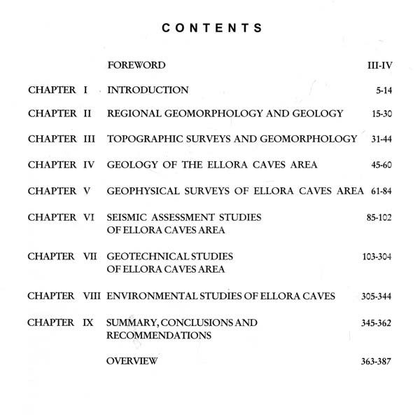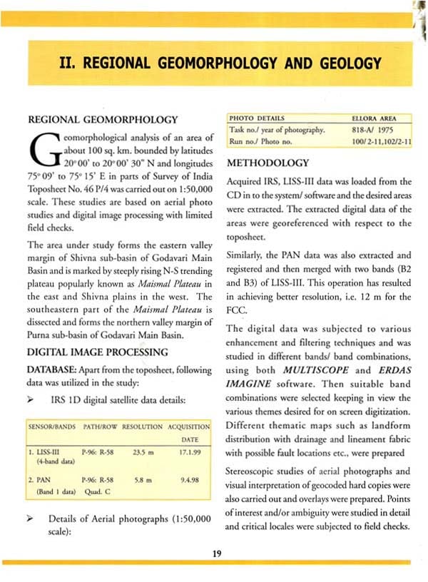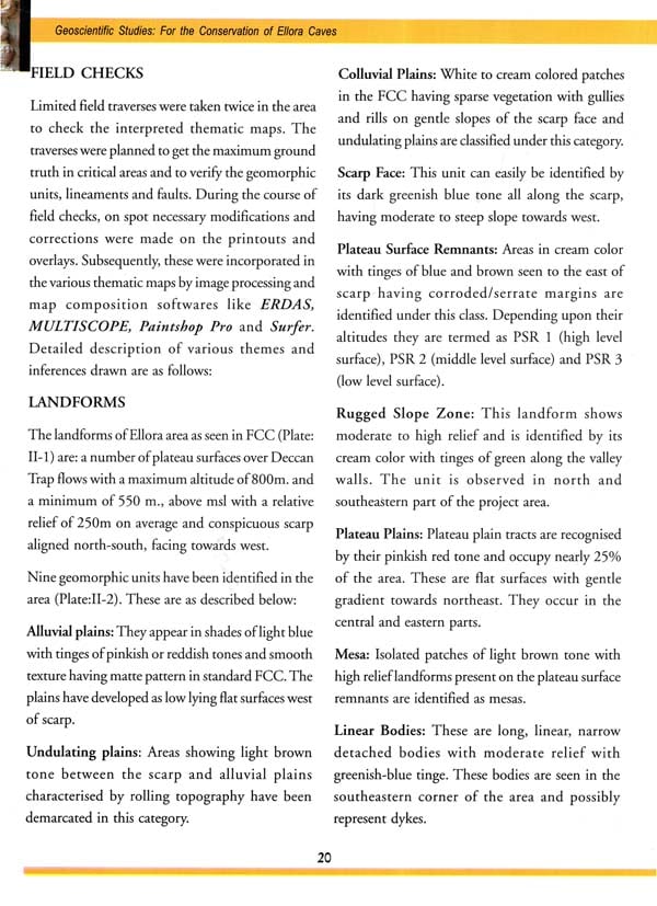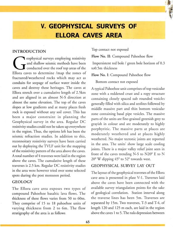
Geoscientific Studies For Conservation Of Ellora Caves
Book Specification
| Item Code: | NAW992 |
| Author: | Manohar Sinha |
| Publisher: | ARCHAEOLOGICAL SURVEY OF INDIA |
| Language: | English |
| Edition: | 2011 |
| Pages: | 387 (Throughout Color Illustrations) |
| Cover: | HARDCOVER |
| Other Details | 11.00 X 9.00 inch |
| Weight | 1.74 kg |
Book Description
Ellora is a magnificent set of rock cut caves and also known as cave temples represented by elaborate carvings of gods and goddesses and are the devotional products of three religious faiths viz Buddhism, Hinduism and Jainism. The ensemble of 34 caves cut out in the Deccan basalt are lying in a north-south direction for a distance of about 2 km situated at 30 km from the city of Aurangabad in Maharashtra. Caves 1 to 12 display Buddhism, 13 to 29 are of Brahminical origin and 30 to 34 exhibit Jainism. Cave 16, which is also known as the `Kailash' is a marvel of cave excavations and displays rock cut architecture at its best. Approximately 0.3 million cubic feet of rock has been excavated to carve out this exquisite cave temple. The ancient rock cut temples are our national heritage and since it is a world heritage monument it is also the pride possession of the mankind but the site is beset with many geological and environment problems.
The natural process of weathering and erosion alongwith retreating scarps have caused degradation of slopes and have damaging impact on the sculptures and paintings in the caves and in environs. Biotic interference has deteriorated the caves and their surroundings even further. Unstable slopes and seepages are the two major causes of concern while attempting preservation of these monuments. Thus the Archaeological Survey of India engaged the Geological Survey of India (GSI) in 1998, to carry out Multidisciplinary Geo-scientific studies of the cave site. The GSI studied out geological, geohydrological and environmental conditions of the site.
Various studies like topographic survey, geological mapping and geophysical surveys were undertaken in the area. Some specialized studies like stereo-photographic studies of vulnerable slopes, geotechnical studies within and outside the caves were done. Seismic assessment by micro earthquake studies and environmental impact assessment of the caves and their surroundings were also carried out. Geological and geotechnical studies were handicapped because only non-interfering and non-destructive methods could be used in and around the monuments. Sub-surface information also had to be collected and inferred from methods other than drilling to examine the rocks.
The GSI submitted an excellent report in 2001 on the studies carried out containing various thematic maps, damage assessment of the site from geotechnical perspective and their remedial measures and have also given suggestion for improving the environ of the caves.
The suggested remedial measures include shotcrete with rock bolt at selected places. Construction of new drains and the improvement of the existing caves by providing fresh lining. The potential benefits of shotcrete as surface support have been realized to a progressively increasing extent in the past decade. Shotcrete can be used to clad the rock surface and to fill in the undulations in the rock surface, control water seepage, protect steel components against corrosion and to provide a tough wearing surface to retard progressive weathering. The initial application of shotcrete close to the face stabilizes ground and promotes quality bolting, meshing and lacing.
The comprehensive Geoscientific studies for the monuments housed in the rock have been carried out for first time in the country. Similar studies have been carried out for seven sites in the states of Maharashtra and Madhya Pradesh beginning from 1998. Some of the suggestions have already been implemented by the ASI. The protection measures involving the facades and inter-cave areas need more detailing to facilitate the Implementing Agency to design the measures. The protection measures like shotcreting and rock bolting of facades have not yet been implemented since they involve many other aspects on which a holistic approach is to be taken.
The Archaeological Survey of India is publishing the report containing the accounts of multidisciplinary Geoscientific studies for providing the first hand detail information of the site on which further studies and research can be carried out to evolve the most suitable measures for the sites which should take care of the aesthetic beauties of the site and its integrity. I am sure the publication will provide the archaeologists a document, the reading of which will help them in understanding the intricacies of the rock surface which play an important role in determining the protective measures. The Ajanta report has already been published and this is the second publication in the series of seven publications contemplated. I am confident it will also provide a good reading for all those who have interest in the monuments of the country.
ARCHAEOLOGICAL AND HISTORICAL PERSPECTIVE
Ellora caves represent an unique repository of magnificent rock cut caves belonging to early medieval period of Indian history. This assemblage of 34 caves carved in the Deccan basalt is visible for a distance of about 2 km in north-south direction and is situated at a distance of 30 km from Aurangabad in Maharashtra. It was declared World Heritage site in 1983 by the UNESCO.
Ellora caves display three major religious traditions of the Indian sub-continent, Buddhism, Jainism and Brahmanism. The caves were carved over a period of five to six centuries and they exhibit technological development in architectural style. The need for monsoon retreats for itinerant monks was the guiding factor for making cave retreats. The earliest of such caves are found in the Nagarjuni and Barabar hills in Bihar and were made in the 3rd century B.C. Thereafter cave architecture flourished in the Deccan under the patronage of rich Buddhist and Jain merchant guilds. The last phase of Buddhist cave architecture in Western India is seen at Ellora. The architecture and sculpture here shows some continuity with the earlier cave temples of Ajanta, Bagh and Kanheri. Here the shrines are larger and the sculptures are lavish in scale and prolific in detail.
This part of Deccan had been inhabited in the late middle stone age as evidenced from the occurrence of stone tools of Jasper, attributable to an industry of the pre-microlithic facies and subsequently in the microlithic and chalcolithic periods. The history of the Ellora caves begins within historical times, a little over five hundred years after the birth of Christ. However, it is very intriguing that the Satavahanas, whose coins have been picked up from the vicinity of the caves and during whose times the trade-route was in use, have not left any trace of their activity on this hill. The historical antiquity of the caves together with their authorship beyond doubt still remain to be established. However, putting together all evidences it is now generally believed among historians that by the close of the sixth century the excavation of the Buddhist caves began at Ellora. The chronology of the caves can be put in three periods, pre-Rashtrakuta, Rashtrakuta and post Rashtrakuta phase. The excavations of Buddhist group of caves 1 to 11, caves 15, 16 and 22 to 28 in the Brahamanical group and caves 30 to 32 in the Jain group belong to the Rashtrakuta period. The excavations of Buddhist group of caves 1 to 11 and other Brahamanical excavations excepting cave 21 may be assigned to Chalukyas, the predecessor of the Rashtrakutas. However, the cave 21, Ramesvara, has an image of Lakulisa on the architrave of the main entrance to the temple and is purely Saiva in character. It may be ascribed to the Kalachuris of Mahishmati, who were avowed Pasupatas, styling themselves Parma-mahesevara. The historical findings indicate that they wielded Power over a territory from Nasik to a part of the ancient Asmaka Bhogavardhana. Bhogavardhana has been identified with modern Bhokardan, Aurangabad district, about 50 miles to the east of Ellora, The Kalachuri association of this cave is also identified by the find of a silver coin of krishnaraja just in front of the cave.
The excavation of the caves has to be sequenced with ruling dynasties, the activities probably were initiated by the Kalachuris, followed by the Chalukyas in an atmosphere of tolerance. The successors of the Chalukyas, the Rashtrakutas maintained the harmony and tolerance amongst the followers of three religions Buddhist, Brahmins and Jains during the ninth century and promoted competition with each other in representing their respective religions art. It was this atmosphere of peaceful co-existence that made it possible for different religions communities to forget their rivalry and Ellora witnessed them working together, borrowing motives and conceptions from each other. The Jains were active at Ellora even during the rule of Yadavas in the thirteenth century.
The caves of Ellora were never lost in oblivion because of their close proximity to the ancient trade route and the accounts left by the eminent persons from time to time. The earliest reference of Ellora caves is found in the accounts of Arab geographer Al-Mas'udi. Subsequently, Firishta mentioned the caves in connection with the romantic capture of princess Deval-devi by the party of imperial soldiers in pursue of king Karan Rai of Gujrat. Later, Thevenot (in 1633-67), Niccolao Manucci (1653 to 1708)5 Charles Warre Malet (in 1799) and Seely (in 1824) wrote on these caves.
After the decline of the Rashtrakutas, attention moved away from the caves. The Yadavas who were initially feudatories of the western chalukyas, succeeded the Rashrakutas in the 12th - 13th centuries A.D. The Yadava king Bhillama V made Devagiri his capital and excavated the first stage of the rock fort. They were saivas and may have patronized the Kailasa temple at Ellora.
The Holkars of Indore controlled the region of Ellora including the caves. They used to auction the caves for the right of worship and collection of some sort of entrance fee. The village together with the caves was subsequently exchanged with some land near Hyderabad, after which Nizam acquired the ownership of the caves.
Architectural Development at Ellora:
There are 14 to 15 Brahminical caves between the Buddhist and Jaina caves. In their earlier caves, the Brahamans copied to a certain extent the arrangements of those belonging to the Buddhists, though gradually emancipating themselves from their influence till the series culminated in Kailasa, the largest and the most magnificient rock-cut temple in India. The dice game between Siva and Parvati is peculiar to Ellora, while other motifs appear at Elephanta and elsewhere. Raven Ki Khai sculpture is reminiscent of Tantric practices owing to the recurrence of images of Kali. Lakulisa Siva was an important Kalachuri deity. Kailasa is similar in design to the Virupaksha temple at Pattadakal. At Kailasa the work commenced not from the face of the rock, but from three mighty trenches cut in the solid rock, two of them at right angles to the front of the rock and the third connecting their inner ends leaving nearly an isolated mass in the middle to be carved both on the outside and interior into a great monolithic shrine with numerous adjuncts. It measures 164 feet from east to west and 109 feet across, rising to a height of 96 feet to the top of the dome. Interiors were plastered over and painted, perhaps the latest layer was during the Ahilyabai period of temple restoration. Sculpture was a form of political iconography during the reign of the Rashtrakutas, as Krishna I, sponsor of the Kailasa temple, had his coronation inside the temple.
The Rashtrakutas also sponsored building many of the Jaina caves, which were developed during their reign, as the Rashtrakuta Amogvarsha I was a Jain. Jaina caves are separated by a distance of about 200 yards from the Dumar Lena (cave 29) and occupy the northern spur of the hill called Charandari. These are cave 30-34 and they date from 8th to 13th century. Cave 30 known as Chhotakailasa is a curious example of the imitation of the works of one sect by the votaries of another on a much smaller scale.
An attempt was made to imitate the cave 16 known as Kailasa but it ended in an incomplete excavation. However, it may also be concluded on the basis of similarity in design with Kailasa that these two temples cannot be far distant in date.
GENERAL INTRODUCTION
Situated at the foot of a N-S trending hill range showing a relief of about 120 m, with extensive plains of the Shivna river to the west, are the cave temples of Ellora representing elaborate carvings of gods and goddesses of three major religious faiths prevalent in India.
The natural processes of weathering aided by agents like wind, water, temperature variations, biotic interference, along with scarp retreat have had a serious and deleterious impact on the sculptures and paintings in the caves and its environs. These have affected macro as well as microstructures in the rocks, to bring about a gradual deterioration in the rockmass quality. Grade II weathering signifying slightly weathered rock, is prevalent in most of the exposures outside the caves, while the rock inside the caves are generally fresh and unweathered. Patches of moderately weathered basalt are seen in the toe portion of some caves and in inter cave areas. The thickness of the weathered zone is around 1- 2 m. Accentuated weathering is seen along basaltic flows unit contacts, which has led to the destruction of many pillars. Unstable slopes and seepage are the two major causes of concern that are to be mitigated while applying conservation methods.
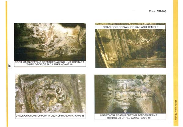
Slope stability problems at Ellora are confined to the cave portals and the adjacent inter cave slopes that bound them. The slopes immediately behind the caves are flatter / gentler and stable. Deep semi-circular scarps, 20 to 37 m in height have been formed by water action of cascading nalas near caves 5, 17, 24 and 29. The outer portions of caves 1 to 9 have perished, creating an overhanging block from which certain parts have been dislodged. Overhangs created by excavation of caves have also become vulnerable at a few places, especially in cave 16. Other than this, certain blocks have collapsed due to separation along flow unit contacts. Stability problems, which are in general restricted to the outer 1-4 m in most caves are due to overhangs created by differential weathering and also due to jointed and fractured blocks. The cave interiors are relatively stable. The presence of sets of joints, three vertical and the fourth a steeply dipping set of relief joints alongwith the fracture zone and cooling cracks, have accentuated weathering and rendered the cave facades and certain slope segments weak. Wherever this fracture zone has intersected the cave openings, the outer portion of the caves has collapsed as seen in caves 1- 4, 13 and 14. The relief joints with progressive under-cutting of toe have played a major role in the retreat of the slope face by about 5m.
The process of valley formation and widening has been active and the scarp face has been retreating there by rendering the slopes unstable. The outer portions of a few caves are destroyed. Interior of the caves are relatively stable while the facades and verandahs show varying degrees of instability.
Seepage of water in the caves is restricted to the outer 2 -3m portion of the caves. Surface run-off flowing down the slope permeates down the cracks causing seepage. Some water seepage is because of surface water roll back due to surface tension.
**Contents and Sample Pages**
