Environment and Settlement Pattern of the Harappan Civilization in the Chautang Basin
Book Specification
| Item Code: | NAN436 |
| Author: | Tejas Garge |
| Publisher: | B.R. Publishing Corporation |
| Language: | English |
| Edition: | 2017 |
| ISBN: | 9789386223005 |
| Pages: | 432 (Throughout Color and B/W Illustrations) |
| Cover: | Hardcover |
| Other Details | 9.5 inch x 7.5 inch |
| Weight | 1.20 kg |
Book Description
The Chutang is now an extinct river represented by a dry channel flowing through parts of Haryana and Rajasthan. It was thickly populated during proto-historic period and the present study is spatio-temporal analysis of settlements of Early, Mature and Late Harappan periods (3200 B.C. to 1800 B. C.) in the Chautang basin to understand the Harappan settlement system on a regional scale. The environmental factors are also taken into account in a great deal while demonstrating rise, development and fall of the Harappan culture in the Chautang basin. Further it describes 377 archaeological sites in details. Revision of chronology and re-classification ceramic assemblage of the Harappan period are also major issues discussed here in length. Further this book also attempts to explain a five-tiered settlement hierarchy and estimating population which existed in the Chautang basin during the Harappan period.
Dr. Tejas Garge has been working in the field of archaeology and heritage management for past two decades focusing on the Harappan Civilization, fortifications and firearms, museum and exhibition, Indian art and architecture. After graduating from Pune University in history and post-graduation as well as doctorate from the Deccan College Post graduate and Research Institute, Pune he secured first rank in post graduate Diploma from Institute of Archaeology, ASI, New Delhi. While working in the Archaeological Survey of India and Indian Archaeological Society he has participated in number of archaeological expeditions in Rajasthan, Haryana, Gujarat, Uttar Pradesh, Goa and Maharashtra. He was also deputed to the Republic of China and USA on official assignments. He has presented papers in many international and national conferences. He has published several articles in international, national and regional research journals along with magazines of popular interest and newspapers in English and Marathi. He is also co-author of six books- Treasures of Ancient India, Cannons of Goa, Monuments of Aurangabad Circle, Lithographs of Ellora Caves, Cannon from the Western Coast of India (Rewdanda(Chaul), Korlai, Janjira & Padmadurga) and Inventory of Monuments and Archaeological Sites, Aurangabad Circle. He is also a visiting faculty as a lecturer to Mumbai University, Mumbai, Dr. Babasaheb Ambedkar Marathwada University, Aurangabad, Tilak Maharashtra Vidyapith, Pune and Institute of Archaeology, ASI, New Delhi.
The Harappan culture was spread over an area of more than two million Sq. km mostly in the north-west and western part of the Indian sub-continent. The sites are found spread in different ecological zones and barring two exhaustive studies, one by Prof. Gregory Possehl in Saurashtra and the other by Rafique Mughal in Cholistan part of Pakistan no regional settlement pattern studies have been carried out. The Ghaggar basin was perhaps the most important area of the Harappan culture as more than 2/3rd of the sites are located in this zone. From 1950s to 1970s some attempts were made to discover and study Harappan settlements by A. Ghosh and Katty Frenchman. Their main aim was to discover expansion of the Harappan culture in this area and not to study the settlement pattern aspect. Subsequently, a few scholars from M.D. University, Rohtak have carried out block-wise explorations and discovered a number of Harappan settlements in the Ghaggar and Chautang basin but the settlement pattern aspect was not dealt with. In the light of the background, the present work stands up clearly on accounts of the discovery of the sites and settlement pattern studies. The spatial distribution of the cultural phenomenon is one of the most interesting branches of enquiry in the field of archaeology. It is study of spatial distribution of human activities and occupation ranging from different locations of activities within a single room to the disposal of sites in a region. In simple words, it is a study of why the ancient sites are located where they are. It may be viewed as the working relationship between people, environment and their technology. Almost ten decades of research after the discovery of the Harappan Civilization, main emphasis in Indian research scenario still remains on its geographical expansion and study from cultural history view point.
The present work is study in a geographical pocket which comprises almost 400 settlements (out of total 1400) ranging from Early to Late Harappan period-the Chautang basin was selected to study settlement pattern on the regional scale. Though large numbers of Harappan sites are reported from Chautang basin (between latitudes- 77o to 74° N and 30° and 29° E), this is first attempt to put them in a geographical framework. Certainly higher number of sites shows the importance of the region but the understanding of settlement hierarchy, functional relation of sites, network systems, economic organization, and cultural transformation is yet to realize. In spite of availability of enormous archaeological data, there was no attempt to understand rise and decline of the Harappans in the Chautang basin from the perspective of settlement archaeology. The Ghaggar-Chutang basin was cradle of the farming in the North Western Indian plains. Further the present work is also focused on environmental changes in Holocene period reflecting changes in the material culture.
For the first time, an effort has been made to study settlement system by generating data from the catchment area of some of the key Harappan sites in the study region and synthesizing data from excavated sites like Rakhigarhi, Farmana, Bhiranna etc.. Similar efforts need to be done in the entire Ghaggar basin so that one can understand the reason for such a heavy concentration of the Harappan sites in the region and what features led to the formation of Harappan culture. This will be a useful work for students and scholars dealing with the Harappan culture in general and settlement pattern studies in particular.
The first urbanization witnessed in Indian sub-continent during the third millennium B.C. has always fascinated the archaeological world and common public. Almost eight decades of research Harappan civilization has revealed striking features, which puts Indian history contemporary to the Sumerians, Chinese and Egyptians and even prior to these civilizations. During initial stage of the research it was limited to the area of Indus and confined to the issues of race, language and culture.
After partition of India and Pakistan, there was a fresh emphasis to understand spatial expansion of the civilization especially in the Indian part, as all the known Indus sites except Kotla Nihang Khan and Rangpur were located in Pakistan. In 1952, A. Ghosh of Archaeological Survey of India carried out systematic explorations in the Ghaggar valley and by reporting number of archaeological mounds of Harappan as well of historical period, led solid foundations of Harappan research in post-independence India. In 1963 S.R. Rao of Archaeological Survey of India reported about 88 sites from Gujarat. Similarly, in 1972 Suraj Bhan reported large number of Harappan sites from Ghaggar and its tributaries. Gregory Possehl in 1980 and J.P. Joshi in 1984 added to the number of Harappan sites. Later on many institutions, M.S. University, Kurukshetra University, State Department of Archaeology- Gujarat, Haryana and Punjab have also contributed valuable information about horizontal expansion of the Harappans. Today out of 1400 known sites, 917 sites are in India and 481 in Pakistan. Again out of these 1400 sites 1097 are located between the vast plain between the Indus and Ganges, certainly area of the extinct Ghaggar- Hakra valley and only 44 sites are located in the proper Indus valley. "It will be clear from the above account that the focus of the Harappan Civilization was not the Indus and its tributaries but on the Ghaggar- Hakra and its tributaries which flowed between the Indus and the Ganges rivers" (Misra, 1994:512)
Looking at the distribution pattern of Harappan sites in India Haryana has highest number of Harappan sites 323, followed by Gujarat with 230 sites, Punjab 147, Uttar Pradesh 133, Rajasthan 75, Chandigarh 4, Himachal Pradesh 3, Delhi I, Jammu 1 and Maharashtra 1. This distribution of sites does not represent actual distribution patterns as the state is a modern division. From the perspective of cultural geography, regions are more useful tools. On the basis of geographical zones the entire Harappan sphere of influence is divided into seven provinces (Fig.1) - Northwestern domain, Kulli domain, Sindhi domain, Harappa domain, Cholistan domain, Sorath domain, Eastern domain (Possehl, 1997:438). This division is not widely accepted as some 'domains' project almost similar cultural traits, for example, the eastern domain and Cholistan domain are culturally similar. Thus, dividing settlements into these domains is not completely convincing idea, so far no better political division has been proposed so far.
This regional division of Harappan sites is very broad and general. Within these broad regions there are several clusters of settlements. Besides geographical region it is known fact that this civilization was essentially a riverine as it was spread along the banks of dried up Ghaggar- Hakra and Indus. The grouping or clustering of the Harappan sites is essentially governed by these river systems. The main focus of the present thesis is cluster of Harappan settlements along the Chautang basin in the 'Eastern domain'. Geographically this area comprises sites spread in the upper reaches of Ghaggar and whole of Chautang basin as well as the area to the east of Yamuna. But the present work is confined to the Chautang basin.
The Ghaggar River system emerging from lesser Himalayas and piedmonts passing through Haryana, Rajasthan enters into Bahawalpur region of Pakistan. The Chautang was a major feeder to the Ghaggar during the Harappan period. Again if we compare the distribution of Harappan settlements along Ghaggar-Hakra three major clusters of sites are noticeable. First is along the Upper reaches of Ghaggar, Second major cluster is of sites spread along the Chautang and third cluster located along the mighty flow of Ghagger after Upper Ghaggar and Chautang meet at Suratgarh in Rajasthan. It is interesting to note that in comparison to the middle reaches of Ghaggar and Chautang there are very few sites aling the upper Ghaggar region (Fig.2). The Chautang river basin dominates the eastern domain of the Harappan Civilization as almost 400 sites are situated along with it. Besides number, presence of one of the largest Harappan sites- Rakhiagrhi is ample evidence to state that this area played vital role in Harappan period.
Though large numbers of Harappan sites are reported from Chautang basin (between latitudes- 770 to 740 N and 300 and 290 E), no attempt, so far has been made to put them into theoretical framework. Certainly higher number of sites shows the importance of the region but the understanding of settlement hierarchy, functional relation of sites, network systems, economic organization, and cultural transformation is yet to realize. The Chautang basin being a separate geographical pocket offers an excellent opportunity to study settlement pattern of the Harappan culture on regional level, not only as a tool but also a perspective.
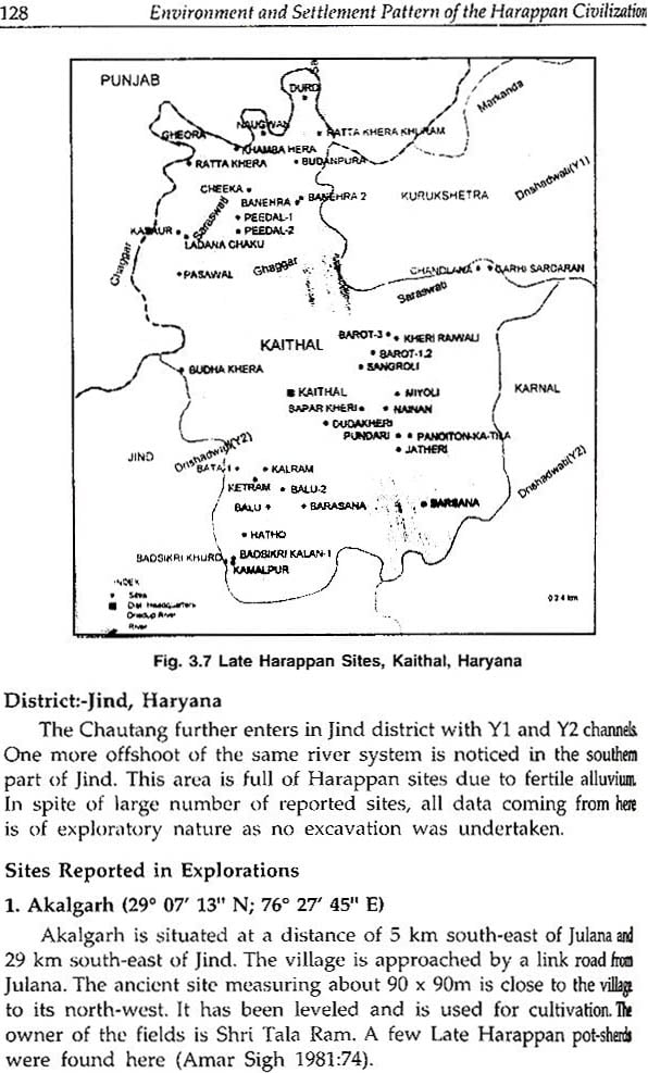
The Chautang rises in Siwaliks, close to Saraswati and they flow parallel to one another for some distance, but the Chautang takes a•more southerly course. It turns west, passes Hissar and the well-known archaeological sites of Siswal, Sothi, Nohar and Rakhigarhi. It joins the Ghaggar near Suratgarh with the sites of Kalibangan and Rang Mahal occupying places of prominence at this strategic junction. Several archaeologist and geographers have argued strong in favour of identification of this river with the ancient Drishadvati mentioned in the Rigveda. In terms of modern political division the Chautang starts from Yamunanagar district of Haryana passes through Kurukshetra, Karnal, Kaithal, Jind and Hisar all districts of Haryana state in India. After Hisar it enters in Rajasthan and united with Ghaggar near Suratgarh in Hanumangarh district (Fig.3). At present it is dry river; its old channel is filled with silt and sediments; covered by aeolian sand at many places.
History of Archaeological Research in the Chautang Basin
L.P. Tessitori was the first scholar to visit sites of archaeological and antiquarian interest on behalf of Archaeological Survey of India. Tessitori was an Italian scholar surveying Bardic tradition in Rajasthan, made request to Archaeological Survey for financial assistance. John Marshall agreed upon financial assistance with the condition of compilation of monument list of Rajasthan. Thus, in 1916 Tessitori started surveying antiquarian remains in the state of Bikaner and came across several mounds; locally known as 'theries' covered with brick-bats and potsherds along the dried-up channel of Ghaggar river. The summery of his explorations was regularly published in the Asiatic Society's journal. His unpublished reports give vivid descriptions of archaeological sites like Sothi, Nohar, Kalibanaga and Pilibanga. The site of Kalibanga seems to have captured his mind as it became reference site for the description material found from other sites. His descriptions of Kalibanaga antiquities include- stone blades, seals, baked clay lumps, pottery, terracotta figurines etc. He also carried out limited digging and found structures like rectangular rooms and a well.
| Foreword | v | |
| Acknowledgements | vii | |
| List of Plates | xi | |
| List of Figures | xv | |
| 1 | Introduction | 1 |
| History of Archaeological Research in the Chautang Basin | ||
| Aim and Scope of the Present Work | ||
| Research Methodology | ||
| Concepts of settlement pattern and its application | ||
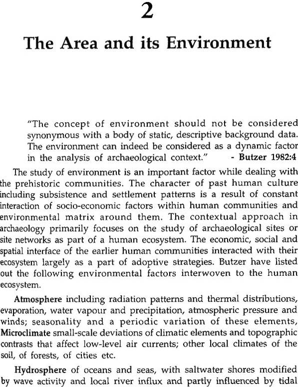
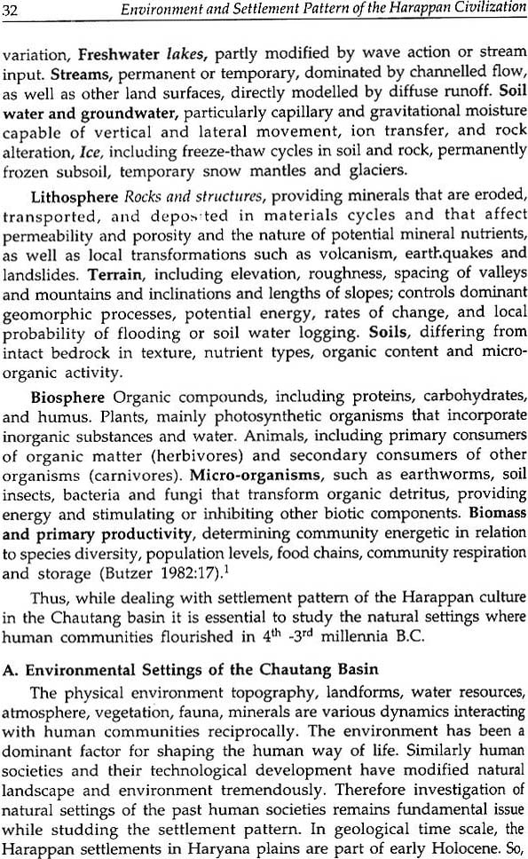
| 2 | The Area and its Environment | 31 |
| A | Environmental Settings of the Chautang Basin | |
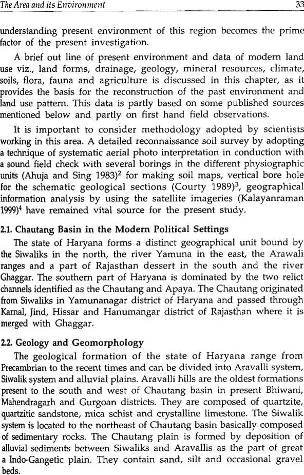
| 2.1 | Chautang Basin in the Modern Political Settings | |
| 2.2 | Geology and Geomorphology | |
| 2.3 | Physiography and Landforms | |
| 2.4 | Soils | |
| 2.5 | Drainage System and Water Resources | |
| 2.6 | Climate and Rainfall | |
| 2.7 | Natural Vegetation-Flora | |
| 2.8 | Fauna | |
| 2.9 | Rock and Mineral Resources | |
| 2.10 | Modern Land use Pattern | |
| 2.11 | Dispersal of the Modern Population and Pattern of Urbanization | |
| B | Reconstruction of the Past Environment/Environmental Changes in Drishadvati Valley | |
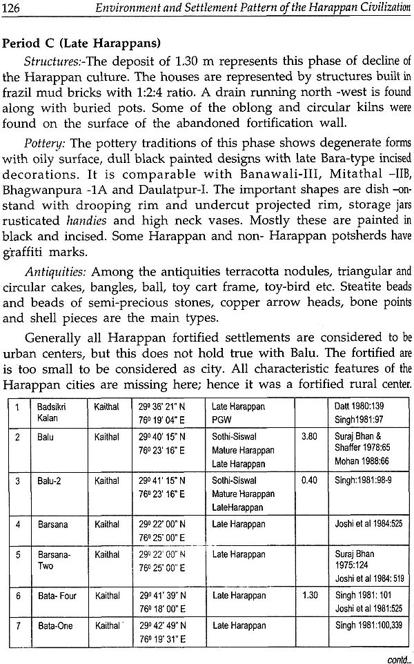
| 3 | Harappan Settlments in the Chautang Basin | 95 |
| 4 | Settlement Patterns in the Chautang Basin | 201 |
| 5 | Land use Pattern of the Harappan Rakhigarhi | 293 |
| 5.1 | Reconstruction of Economic aspects by using Site Catchment model | |
| 5.2 | Use of modern ethnographic model to explain cultural traits of the past | |
| 5.3 | Modern layout and patterns of Settlements | |
| 5.4 | Agriculture | |
| 5.5 | Pottery Manufacturin | |
| 5.6 | Brick Manufacturing | |
| 5.7 | Gausa Storage | |
| 5.8 | Aarha and padtoralisum at Rakhigarhi | |
| 5.9 | Stone Working | |
| 5.10 | Reconstruction of the Landuse Pattern around Rakhigarhi | |
| 5.11 | Economy and Function of the Harappan Rakhigarhi | |
| 6 | Conclusion | 333 |
| Bibliography | 351 | |
| Platas | 365 | |
