Longitudes and Latitudes of the World (With Time Changes and Time Zones)
Book Specification
| Item Code: | NAG182 |
| Author: | Arun K. Bansal |
| Publisher: | Future Point Pvt. Ltd. |
| Language: | English |
| Edition: | 2004 |
| Pages: | 255 |
| Cover: | Paperback |
| Other Details | 8.5 inch X 5.5 inch |
| Weight | 300 gm |
Book Description
Sh. Arun K. Bansal, a pioneer of Computer Astrology, developed first program on astrology in 1981 when the computers were not so popular in India. He floated the company Future Point (P) Ltd. in 1987. He developed programs on various systems of astrology like Parashar, Jaimini, Tajak and K.P. Leo-1 and Leo-99, the best Astrological Softwares available as on date, have been developed by him. Development of Pocket Computer “Leo-PC”, publishing of monthly bilingual astrological magazine “Future Samachar”, convening of various conferences and seminars, holding astrological classes and publishing books are few of his other works for the upliftment of astrology and related sciences.
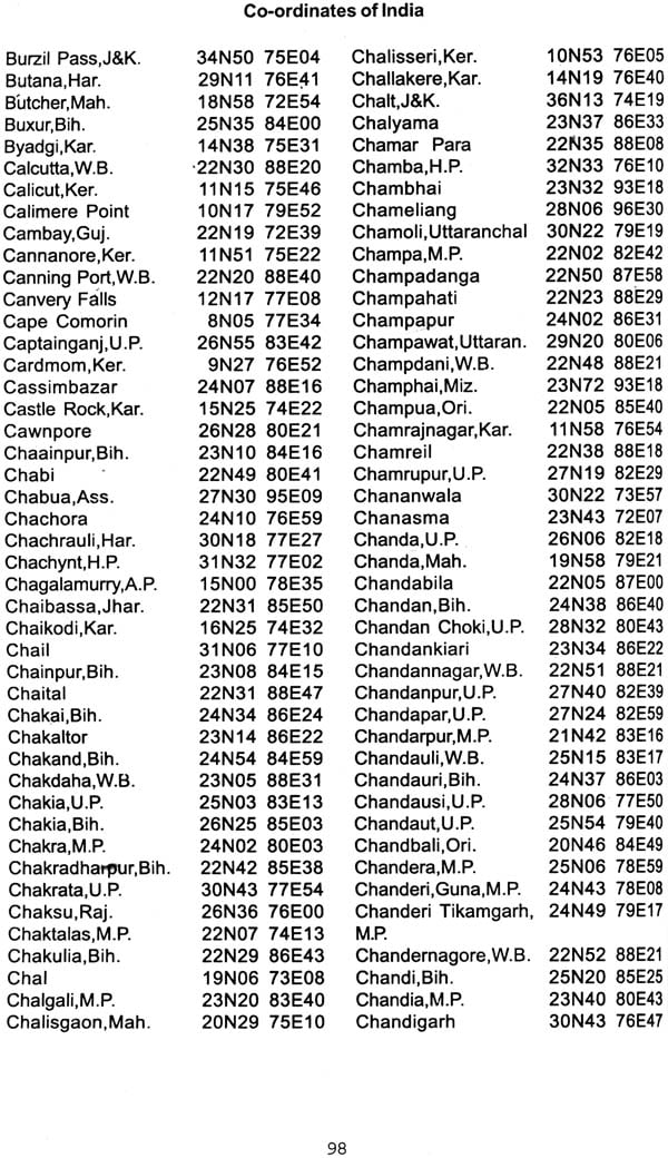
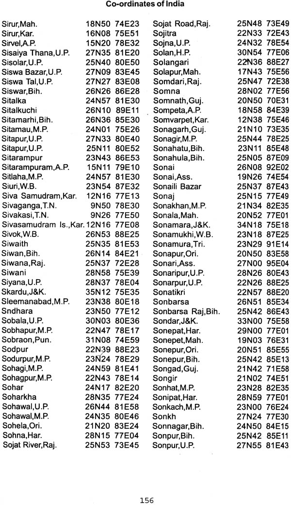
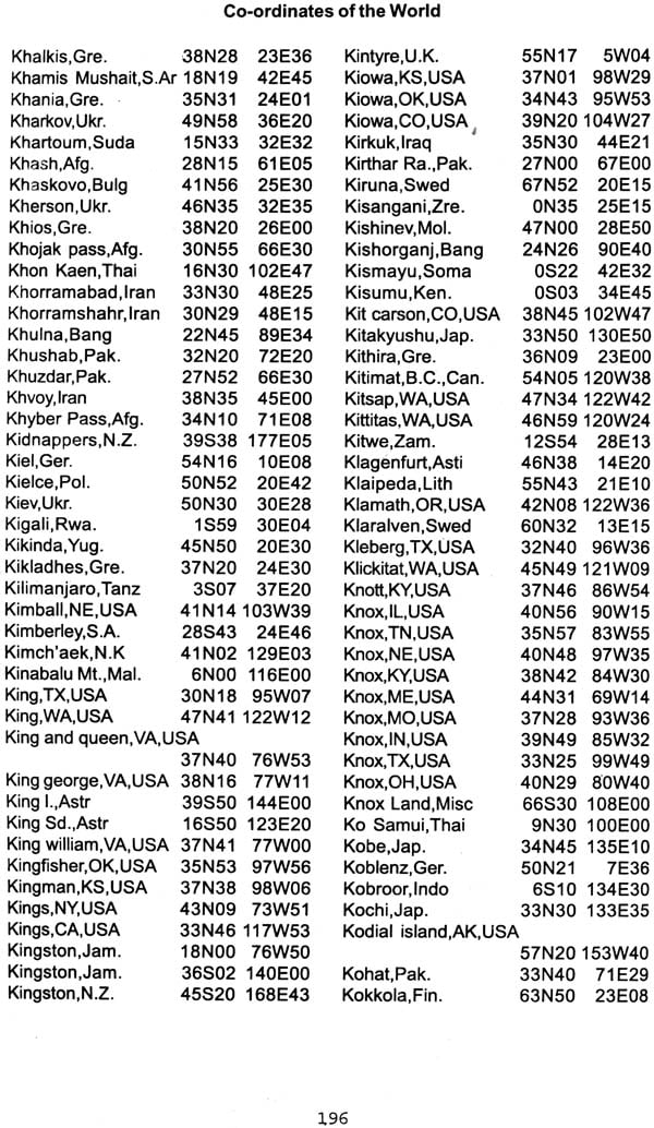
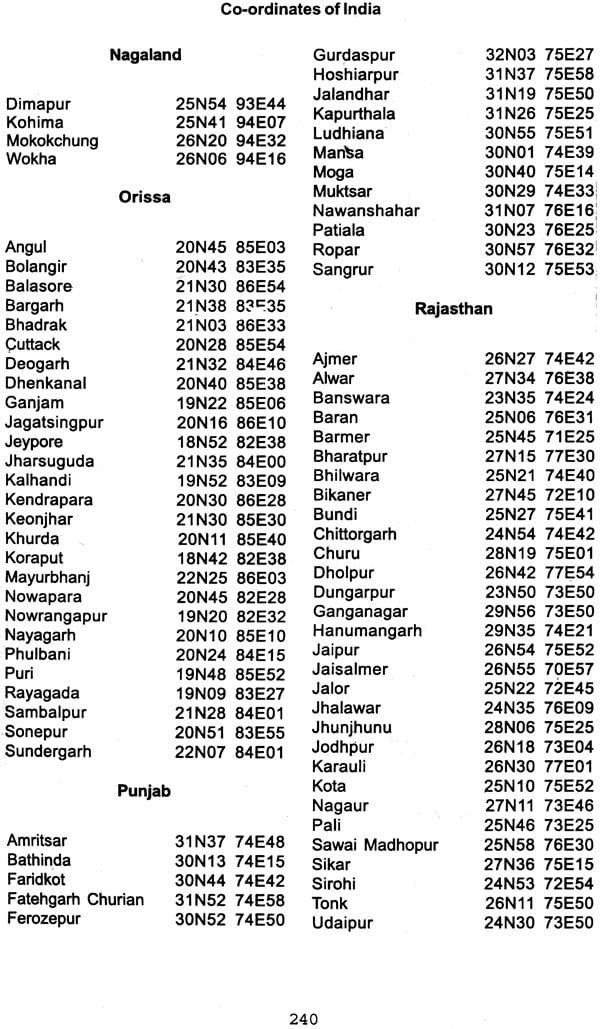
This book contains the most wanted time changes and time zones of the world alongwith about 12,000 longitude and latitudes. This book also contains the coordinates of various localities and hospitals of the major cosmopolitan cities of India. It describes how the coordinates can be best utilized to determine the distances between two cities and explains effect of the distance between two cities and explains effect of the distance on time and coordinates.
Hope this will be a valuable and most wanted book to the astrologers.
Accuracy in astrological computation is the nerve of correct predictions. Alongwith correct time of birth, it is equally important to have the correct longitudes and latitudes of the place of birth, and not a place near to it. Unlike old days, now it is a generation of computers and correct computations can be done to fraction of seconds. No longer a panchang (Ephemeries) is used which is set for one place on earth. To get accurate results from computer it is more and more important to give a correct feeding to computer and hence correct knowledge of longitude and latitude is very important.
For last so many years there has been a shortage of any such book and looking at the need, we at Future Point which is working to give best astrological computations, have complied the present book to cover over 8000 places of India and 4000 places of the world.
Not only this, we have tried to put state name of every city to uniquely identify a city. For international cities a country name has always be provided.
To make sure that the data is correct we developed the data on computer and it was cross checked for various possibilities thoroughly like city co-ordinates should be within the boundary limits of the state or the country and the longitude should not normally be off from the given time zone by over 15°. Further precaution was taken that after data verification, no manual work is done on the data, which may bring errors.
Another attraction of the book is that we have added coordinates for various hospitals and colonies of the major cities of India viz; Ahmedabad, Bangalore, Calcutta, Chennai, Delhi, Hyderabad, Jaipur and Mumbai. This will definitely help in selecting proper coordinates when large dimensions of the city make a difference in the astrological calculations.
Since even a small town has a dimension of over 2 kms, it is not correct to specific the longitude and latitude in arc seconds unless the town name is associated with some specific address like a building or a crossing or a small colony. For this reason we are restricting ourselves for all the data to arc minutes only throughout the book.
For births in international cities, it is important to know the time zone of the country, or how much it is ahead/behind GMT or IST. We have compiled an, exhaustive list of countries and occupied territories of the world and have given here the longitude latitude of its capital alongwith the time zone. Time correction for the country are also listed separately to know any war time or summer time correction.
I would like to extend gratitudes to Smt. Abha Bansal whose cooperation helped me to complete the task. I would also like to the staff of Future Point particularly Vinay Garg, Ajay Mittal and Arvind Kumar who worked hard to collect, compute, check and recheck the data provided in this book.
We hope the astrologers will find this book very useful and handy. Any suggestions or corrections are humbly requested.
| 1 | Celestial arithmetic. | 9 |
| 2 | Distance vs. Longitude, Latitude | 18 |
| 3 | How to use the tables | 23 |
| 4 | Time Zones and Time corrections of the world | 26 |
| 5 | Time differences from GMT and IST | 50 |
| 6 | Coordinates for Large Cities of India: (Ahmedabad, Bangalore, Calcutta, Chennai, Delhi, Hyderabad, Jaipur, Mumbai) | 54 |
| 7 | Coordinates for India | 83 |
| 8 | Coordinates for the World (Except India) | 165 |
| 9 | Coordinates of Districts of India (State wise) | 236 |
| 10 | Coordinates of Neighbouring Countries | 243 |
| Pakistan | ||
| Bhutan | ||
| Bangladesh | ||
| Nepal | ||
| Sri Lanka | ||
| 12 | Abbreviations Used | 247 |


