Chandigarh - People of India
Book Specification
| Item Code: | NAR134 |
| Author: | K. S. Singh |
| Publisher: | Manohar Publishers and Distributors |
| Language: | English |
| Edition: | 1997 |
| ISBN: | 8173041199 |
| Pages: | 182 (8 B/W Illustrations) |
| Cover: | HARDCOVER |
| Other Details | 10.00 X 6.50 inch |
| Weight | 500 gm |
Book Description
The Anthropological Survey of India launched the People of India Project on 2 October 1985 to generate an anthropological profile of all communities, the impact on them of change and development process, and the links that bring them together.
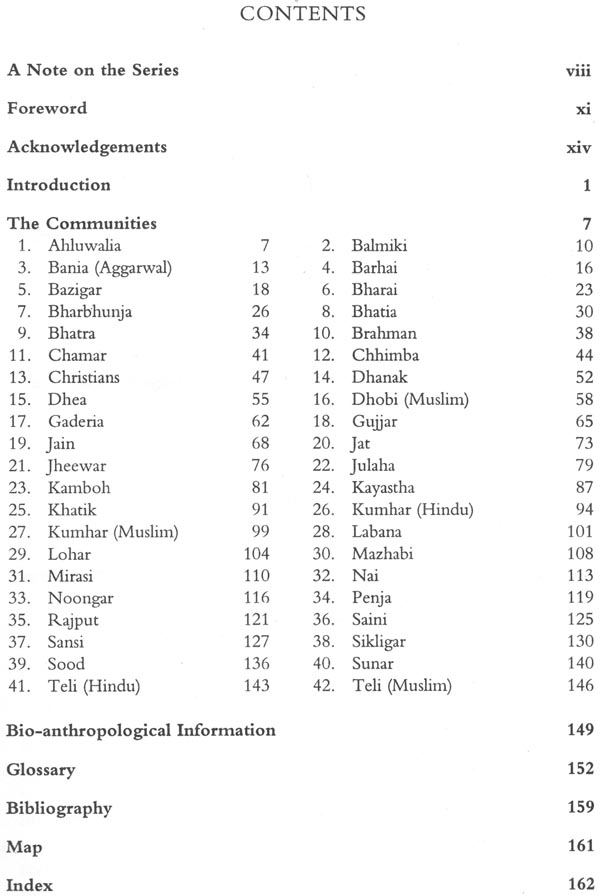
As part of this all-India project, the ethnographic survey of all the communities of Chandigarh (42) was taken up in collaboration with local scholars. The results of this study were discussed at a workshop at Patiala in August 1989 and at Chandigarh in January 1990.
This study would serve as a useful reference tool for all those involved in development activities as well as anthropologists, sociologists and social historians.
K.S. Singh is former Director General of Anthropological Survey of India.
Chandigarh derives its name from the place where the temple of Chandi is situated, a few kilometres away. Chandigarh is an extension of the ethnographic scenario of north-west India, particularly of Punjab and its eco-cultural region, Malwa. However, Chandigarh has evolved its own identity during the recent past. The villages of the Union Territory where the People of India project was conducted still retain their identity in spite of the urban influences emanating from the adjacent city. The project covered for the first time all communities (42) of Chandigarh, particularly village dwellers.
The castes and scheduled castes in Chandigarh, which are generally part of the bio-cultural structure of the north-western populations, have been studied for their various biological traits. Colour blindness varies from 2.75 per cent to 10.00 per cent in the populations. G6PD deficiency is relatively high (5.20-9.62 per cent). The B gene preponderates (22.40-30.72 per cent) over the A (13.16-30.42 per cent), M gene shows a wide range of occurrence (52.00-88.23 per cent). The population of Chandigarh show high frequency of Ri haplotype and a low incidence of r haplotype (15.10-25.00 per cent). Hot gene occur in 18.50-27.10 per cent of population, T613 gene is reported from Chandigarh (0.00-1.39 per cent).
In the Union Territory nine different languages are spoken: Banjari, Hindi, Kangri, Marwari, Pahari, Pasto, Punjabi, Sansi and Urdu. A majority of the communities (24) speak Hindi and Punjabi (17), followed by Urdu (4). There are as many as sixteen communities who are linguistically heterogeneous, i.e. speaking more than one language. The heterolingual communities are mainly those who speak Hindi and Punjabi. The Sirkiband speak either Pahari or Punjabi, and the Bazigar speak either Pasto or Punjabi. The Sansi language spoken by the Sansi/Sansiya is an unclassified language. Pasto belongs to the Indo-Iranian subfamily. All other languages are Indo-Aryan.
According to the 1981 census, Hindi is spoken by the largest number of persons (249,721) followed by Punjabi (182,635 ). Urdu is spoken by 3,118 persons. Hindi, Punjabi, English and Urdu are languages that are commonly used for bilingual communication. Among the Hindi speakers, 73,914 persons are bilingual in Urdu. Among the Punjabi speakers, 60,258 persons are bilingual in Hindi. A large number, 58,069 persons are bilingual in English and 2,010 persons in Urdu.
Devanagari and Gurmukhi scripts are used in the Union Territory.
Like other parts of north-western India, there is a larger concentration of the scheduled castes in Chandigarh (9). The next cluster of communities represents the artisan groups, among whom the Sikligar and Tarkhan are typical. With growing demands many artisan groups from elsewhere, like the Lollar and Barhai, have gone into this area and have been working side by side the traditional artisans like the Sikligar, etc. Some of these groups and service castes are divided into Hindu and Muslim and also Sikh segments, with different stories of origin and relationship prevalent now.
The third category of communities is that of agriculturists. The Jats including the Jat Sikhs are dominant, followed by the Kamboj and Saini, all typical groups of north-western India. Yet another cluster of communities is engaged in business and trade such as the Bhatias, Soods and Banias.
As elsewhere, in this part almost all communities have reported diversification of occupation on a large scale, with the economic growth, and progress in agriculture, animal husbandry, poultry and small scale industries. There are also expanding opportunities for employment as labour, in government and private service and so on. For example, the Labana are no longer trading in salt but have settled down to cultivation and animal husbandry. The Noongars, again a community associated with extraction of salt have taken to selling vegetable and fruit and are engaged in labour. But the Chamars, the traditional leather workers, are also now engaged in cattle-rearing, agriculture and labour. The Chhimba, traditionally dyers of cloth, are now tailors. The Dhanuks described as hunters in ethnographic literature are now engaged in weaving, scavenging and other forms of labour. Gujjars have settled clown to cultivation besides pursuing their traditional occupation in some form or the other. But there are many small communities like the Mirasis who continue with their traditional occupation.
With economic prosperity the levels of aspiration and the range of self perception among many communities have expanded. For example, the Kamboj and Soods not only now perceive their linkages stretching back in time but also spread over a large part of the country and even South Asia.
In this urban situation, a majority of the communities (30) identify themselves 'regionally' across the states, followed by those who identify themselves 'locally' where they feel they belong (26); some identify 'nationally' (15). For most of the communities whose members are mostly literate, ethnographic accounts (26) and historical accounts (19) exist. Twenty-five communities have migrated to their present habitat from neighbouring states.
Chandigarh shares with the rest of the north-west its food and food habits. Wheat is the staple cereal (41), along with rice (32). Maize is taken in winter (35). The cereals are supplemented with gram (36), urad (36), moong (34), moth (24) and maswe (35). Mustard oil (34) and groundnut oil (22) are used for cooking. Peas and beans (27) and roots and tubers (24) are eaten. The intake of vegetables is moderate (29). Most communities are returned as `occasional' non-vegetarians (32) which is higher (76.97 per cent) than the national average of 37.20 per cent. Alcoholic drinks mainly procured from the market (34) are consumed by menfolk (37) on a scale higher than the national average (80.95 per cent against 37.20 per cent). The proportion of those consuming milk (40) and milk products (39) is very high. As an urban centre, with high purchasing power, Chandigarh records a higher level of consumption.
As in other parts of the north-west, internal divisions are reported among 39 communities in villages. These divisions regulate marriage and in some cases indicate status and descent. The communities invoke the norm of community endogamy (40) but intercommunity marriage is also reported (6). Consanguinity exists in a very low frequency though adult marriage is the practice (38), child marriage and tonna surprisingly has been reported among 3 communities. Mates are chosen by negotiation (39). Monogamy is the rule. Polyandry (fraternal) is reported among the Sikligar and Teli and non-fraternal polyandry in one community among them. Polygyny is reported for 3 communities.
The rule of residence is patrilocal (41). People tend to live in nuclear families (40) and vertically extended families (24). Male equigeniture is the rule of inheritance (31), and the eldest son succeeds to the position of authority (42) in family. The status of women is generally considered low (30) even though they play an important role in social functions (32), rituals (35), religious ceremonies (25) and economy (23).
In the urban centres, the population is mainly engaged in government service (22), self employment (15) and labour (21). A few are settled cultivators (6). Bonded labour exists among some communities such as the Penja, Lohar, Balmiki and Sikligar. Caste councils exercise social control (13) and the Panchayats implement welfare measures (23).
Most of the communities profess Hinduism (30) followed by Sikhism (15). The latter has a higher percentage (35.71 per cent against the national average of 2.30 per cent). Only 7 communities follow Islam. The 1991 Census shows a very steep rise in the Muslim population.
Folk/oral traditions (36) akin to those of Punjab and Haryana are reported from the villages of the Union Territory.
Chandigarh has the highest level of literacy. The administration has provided medical facilities, drinking water and employment, which are generally perceived as well distributed among all communities.
Chandigarh, the city beautiful, is situated at the foothills of the Shivalik hills. The name of the city is derived from the temple of Chandi (Chandi mandir) situated near the city. The city is a show piece of modern architecture and town planning. Dr. M.S. Randhava, who had a long spell as the Chief Commissioner and was one of the pioneers in the development of Chandigarh, states (1968): 'The Master Plan of Chandigarh is almost poetic and biological in form. The capital group is its commanding head, the commercial centre its heart, the industrial area its hand, the University, the Museum, the Medical Institute and Engineering College its brain, the road system involving the principle of 7 vs. its arteries and veins, the electricity system its nerves and the green spaces which stretch through from north to south its lungs.
The city of Chandigarh was conceived by Prime Minister Jawaharlal Nehru as a modern capital of the Punjab. The erstwhile Punjab, before partition of the country, had Lahore as its capital. After the partition of the country, Jallandhar functioned as a temporary capital of Punjab, which was later shifted to Shirnia. The need for a new place to serve as the capital of the Punjab was felt, as Shimla was found to be inconvenient due to its location in the heart of the Himalaya, and its extreme weather conditions.
The present site was chosen by the then chief minister of Punjab, Sardar Partap Singh Kairon, because of its natural south-west gradient which was considered ideal for efficient drainage and sewerage. The fertility of soil was considered necessary for development of green parks and meadows in addition to the scenic background of Shivalik hills and the abundance of availability of underground water. The climatic conditions, location away from the Grand Trunk Road and the distance from the international border, as also the flow of seasonal torrents on the east and the west, were other considerations for the selection of the present site. The city was planned in detail by Le Corbusier and construction was inaugurated by Jawaharlal Nehru on 2 April 1952.
Chandigarh is situated at 330 metres above sea level, next to Shivalik range of hills at 76°E longitude and 33° N latitude. The area is submontane and undulating. It is presently surrounded by the states of Punjab, Haryana and Himachal Pradesh. The satellite towns of Panchkula, in Haryana state, and Sahibzada Ajit Singh Nagar (Mohali) in Punjab state, have grown rapidly at the southern and eastern ends of the city. Since the reorganization of Punjab state on 1 November 1966 Chandigarh was made a Union Territory and has functioned as the joint capital of Punjab and Haryana.
The total area of the Union Territory of Chandigarh covers 114 sq. km. The city covers an area of 57.6 sq. km and is divided into 47 sectors and fringe settlements. The rural segment covers an area of 56.4 sq. km with 27 villages around. Sectors 1 to 30 were developed in the first phase of construction whereas the rest are being developed in the second phase. The whole area of about 3,642 hectares has been divided into sectors in such a way that each sector is 1.2 km long and 0.8 km wide in a rectangular grid plan. Each sector has been planned as a self-sufficient unit in its day-to-day needs, such as shopping-centres, schools, milk booths, post offices, local bus stops, rickshaw and scooter stands, a community centre, wide open parks and playgrounds and a dispensary. Houses do not open on to the main traffic roads. Complete segregation of fast traffic has been achieved by development of seven types of roads. Open green belts extend from the north to the south. Complete control on the land use and construction activity within the city and in an area of 16 km radius of the city is being strictly implemented.
The Union Territory of Chandigarh is often referred to as the 'city beautiful' as mentioned earlier and as 'city of roses'; it is a model of architectural grandeur displayed in its systematic lay-out and monumental buildings planned by Le Corbusier. The Secretariat, Vidhan Sabha (State Assembly), High Court and Open Hand (the symbol of the city) in the north, against the backdrop of the Shivaliks, are buildings of architectural excellence. Some other landmarks of tourist attraction are the City Centre (Sector 17), the Punjab University Campus, Art Gallery, Museum, National Gallery of Portraits, Rock Garden, Rose Garden and Sukhna Lake.
The climate of Chandigarh varies from extremes of cold and hot weather with the temperature ranging from 43.2°C in summer in the month of June to 1.2°C in winters in the month of December. The average annual rainfall in Chandigarh is 1115.0 mm, and is fairly well distributed due to proximity of Shimla hills. Maximum precipitation occurs in the months of July and August.
According to the Census of India (1981), the total population of Chandigarh was 4,51,610 individuals comprising 2,55,278 males and 1,96,332 females. It has one of the highest densities of population, i.e. 6,188 persons per square kilometre in the city and 630 in the rural areas. The sex ratio is 770 females per thousand males. The birth rate in 1981 was 45.8 and the death rate 44.4. The Scheduled Castes comprise of 14.09 per cent of the total population. There is no Scheduled Tribe in the Union Territory.
The Union Territory has two towns under its jurisdiction, namely Chandigarh and Manimajra. The area of Chandigarh has increased due to extension of city limits from 46.67 to 58.52 sq. km, during the decade of 1971-81 but the population rose from 2,32,940 to 4,22,841 registering an increase of 80 per cent in the decade. Though the rural area comprises 45.67 sq. km, which works out to 40 per cent, spread over 27 villages, it holds only 6.37 per cent of the population (i.e. 28,769).
Most of the residents of Chandigarh are generally educated and economically well-to-do. Chandigarh, though small, is a well developed education centre. In the Punjab University Campus, there is a Law Department, a Chemical Engineering Department, an evening college and 50 other departments. There are four polytechnics, one Engineering College, one Medical College, one College of Architecture, besides the Post Graduate Institute of Medical Education and Research (PGI), a premier institute of medical research and practice. There are 9 degree colleges, 34 higher secondary and secondary schools, 20 middle schools as well as Government-run model schools. It also has 24 primary schools.
As the Union Territory of Chandigarh enjoys the unique privilege of being the capital of two states, Punjab and Haryana, the civic administration is looked after by Chandigarh Administration which is directly controlled by the Government of India. The territory is well-connected with the rest of the country by road, rail and air. The city has a large industrial belt to its south-east, separated from the main city by a green belt. It has eight industries in the large and medium sectors and about 500 units in the small sector, employing 10,104 workers. The city is well served by electricity, road transport, sewerage and water supply. All of the 22 villages are electrified and provided with metalled roads.
Most of the urban population is either salaried employees or engaged in business or trade, whereas the rural population is engaged in agriculture. About 3,977.37 hectares of land is under cultivation and 41.51 per cent of this is irrigated by wells, tube-wells and kuhals. Wheat is the main crop. Other crops grown in this area include paddy, maize, pulses (gram, masri, urd and moong) and oil-seeds (groundnut, mustard, toria, taramira and sesame). The vegetable demand of the city is fulfilled by the rural area which grows cauliflower, cabbage, brinjal, carrot, radish, potato, tomato, onion, garlic, etc.
A list of 108 communities was originally prepared for Chandigarh. However, 42 communities were finally identified under 'People of India' project in Chandigarh. The township of Manimajra and villages of Attawa, Burail and Maloya were extensively covered for fieldwork. Most of the communities are either the original inhabitants of the villages or have migrated either from Punjab or Haryana. A total of 9 Scheduled Caste communities were studied in Chandigarh. Scheduled Caste communities with population of less than 100 and widely dispersed in the Union Territory were not studied.
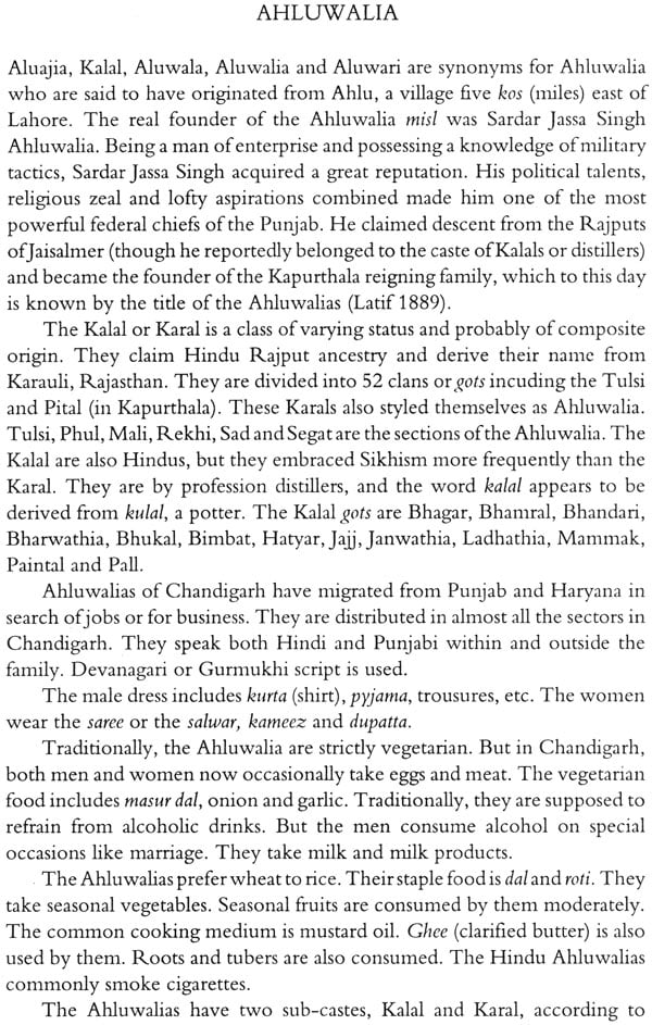
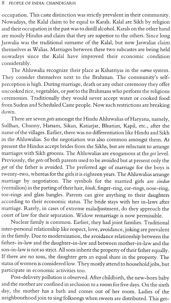
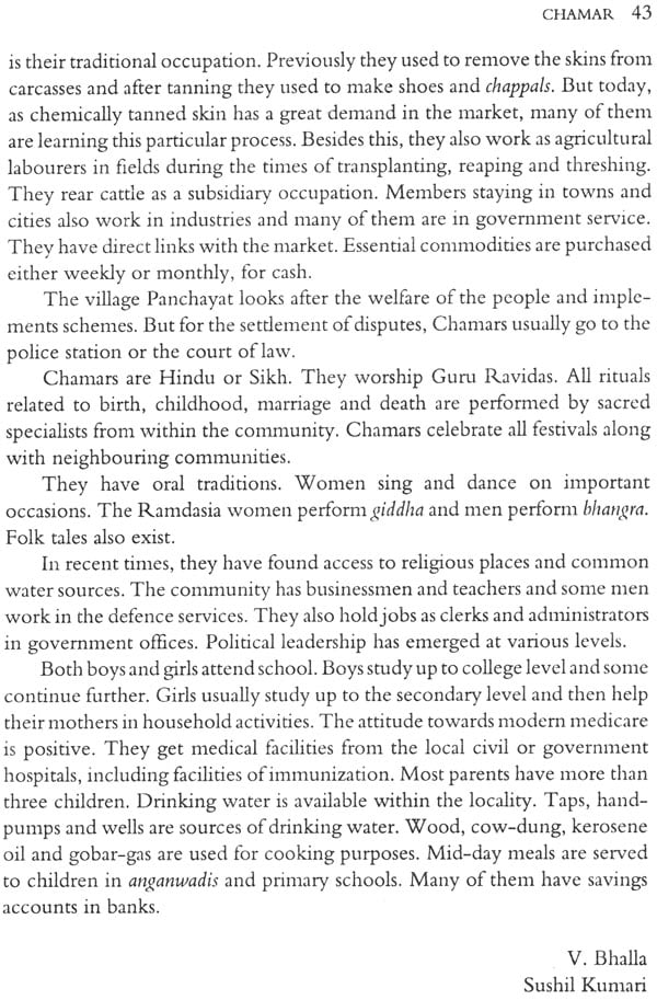
**Contents and Sample Pages**
